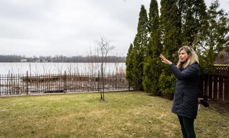
On the bank of the Rivière des Prairies in Pierrefonds-Roxboro, Sophie Sabourin is checking the water again. The pont is not just a piece of infrastructure in this story; it is part of the wider pressure building across flood-prone neighborhoods, where the next rainfall can turn ordinary vigilance into a full household routine.
Sabourin lives on the riverbank, on a lot described as the lowest entry point in the neighborhood. This week, the City of Montreal is preparing for more rain, and she says municipal workers have already come by to open the fence and set up barriers. If water gets in, she says, it will come through her yard first.
Her perspective is shaped by experience. She arrived in 2016, one year before the historic 2017 floods, and remembers a time when, in her words, nobody was truly ready for what was coming. That memory now sits beside a more organized response: protective walls, terrain work at public spaces, and municipal crews showing up earlier than before.
Why does the Pont matter to families living near the river?
In neighborhoods like Pierrefonds-Roxboro, the pont stands for more than access across water. It also marks how close people live to changing river levels and how quickly daily life can be disrupted when the ground is low and the bank is exposed. Sabourin says the situation is still a risk, but one that residents have learned to live with, even if it means “a few weeks of stress” each year.
Daniel Mitchell, who lives a few streets south, describes a different kind of impact. The water usually does not reach his home, but during stronger rain, he says his pump is not enough and his basement takes on water. His account shows how flooding in the area does not always arrive the same way, yet it still reaches people through damaged property, added work, and uncertainty.
What is the wider flood risk across Quebec?
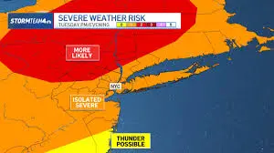
The concern in Montreal fits into a broader weather pattern. Environment Canada has a special weather statement in effect in several areas, with 15 to 25 millimeters of rain expected in some sectors and about 15 millimeters in Montreal. The agency says the rain could lead to flooding because river levels are already high and the ground is saturated.
That warning helps explain why residents are being told to stay alert. In Montreal, Pierrefonds-Roxboro is watching the river closely, while elsewhere in the province the forecast includes heavier showers, cloud cover, and a return to better weather later in the week. The message is consistent: when the ground is already full, even a moderate system can add pressure.
What are cities doing before the water rises?
Local governments are trying to get ahead of the risk. In Pierrefonds-Roxboro, Mayor Jim Beis says the borough has purchased $1. 5 million in equipment and is moving supplies where they are needed. He adds that pumps have been rented and ready for about a month and a half, so they can be deployed quickly if conditions worsen.
Residents are also being urged to monitor official municipal information and the Crues Grand Montreal platform from the Montreal Metropolitan Community to track water levels. In the Laurentians, the same strain is visible in a different way: the Pont Viau in Saint-Jérôme was closed Wednesday evening because of the high flow of the Rivière du Nord, with traffic blocked for an indefinite period for safety reasons.
That closure is a reminder that the issue is not limited to one river or one borough. When water climbs, roads, bridges, and backyards all become part of the same emergency rhythm. For Sabourin, who has watched the river since before the floods of 2017, the sight outside her home is familiar, but never routine. She keeps checking. The pont remains open or closed in one place, while in another, the question is whether the next rise will stop at the yard gate or come through it.