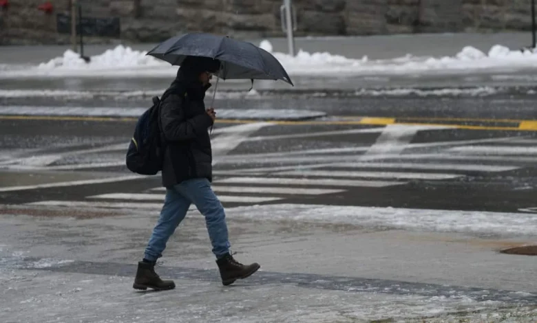
Environment Canada has issued warnings for pluie verglaçante that could make the start of the weekend unusually slippery across several Quebec regions. The risk is highest Saturday morning (ET), with forecasts calling for a thin glaze — up to 2 mm — that should melt during Saturday afternoon (ET) as temperatures climb. While not expected to trigger widespread power outages, the brief layer of ice presents a concentrated hazard for vehicles and pedestrians on several key corridors.
Pluie Verglaçante: Regions and Roadways to Watch
The warning targets a broad swath of central and eastern Quebec. Areas specifically mentioned include the Mauricie, Capitale-Nationale, the Saguenay region, Charlevoix, the Gaspésie and the Haute-Côte-Nord, extending from Saguenay toward Sept-Îles. The Bas-Saint-Laurent, particularly zones adjacent to New Brunswick, may also see impacts. Environment Canada highlights that route 138 toward the Côte-Nord and route 175 through the Réserve faunique des Laurentides warrant close monitoring; Autoroute 40 between Trois-Rivières and Québec could be affected, whereas Autoroute 20 between Montréal and Québec is expected to be spared. The localized nature of pluie verglaçante means travel risk will vary sharply over short distances.
Background and Context: Why This Matters Now
The forecast arrives alongside a broader warm spell. Many southern sectors will see rain rather than freezing precipitation, with heavier accumulations elsewhere: Outaouais and parts of the Capitale-Nationale may reach or exceed 25 mm of rain, while other regions can expect between 10 and 20 mm. In the south, some areas could see up to 10 mm under notably mild conditions, with temperatures near 11°C reported in parts of southern Quebec. In contrast, northern zones such as Abitibi and areas north of Saguenay are forecast to receive heavy, wet snow later Saturday. The combination of a brief freezing-rain event followed by rapid warming means the window for hazardous conditions will be short but intense in places where pluie verglaçante materializes.
Expert Perspectives and Operational Impacts
Julien Pellerin, meteorologist, Environment Canada, notes that the warming is expected to be temporary and that alternating systems of rain and snow will return after the short spell. Environment Canada has estimated maximum local glaze accumulations near 2 mm. That quantity is unlikely to cause major electrical outages but is sufficient to make roads and sidewalks glazed and slippery. Agencies have emphasized caution, suggesting that delaying nonessential travel into late Saturday afternoon (ET), when melting is expected, would be a prudent option for commuters and emergency services planning.
Operationally, even a thin, ephemeral layer of glaze can concentrate impacts on bridges, overpasses and shaded sections of roadway, increasing collision risk and stranding potential in isolated stretches. Municipal and provincial highway crews will need to prioritize treatment on the stretches highlighted by the warning, balancing resources between surface treatments for freezing rain and preparations for heavier rainfall totals in adjacent regions.
Looking Ahead: Regional and Safety Implications
For residents and planners, the immediate practical steps are straightforward: expect a brief period of icy conditions Saturday morning (ET), track local updates from Environment Canada, and consider postponing midday travel where feasible. Transportation managers must remain ready to switch from anti-icing strategies targeted at a thin glaze to standard drainage and runoff management as temperatures rise and precipitation becomes regular rain. The spatial contrast—heavy rain and even mild double-digit temperatures in the south versus freezing precipitation and wet snow elsewhere—underlines how a single weather system can produce divergent hazards across a single province.
Will the brief episode of pluie verglaçante prompt adjustments in travel behavior and road treatment priorities this weekend, and how effectively will crews transition from freezing-rain response to managing heavier rain and melt-driven runoff?