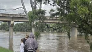
A blizzard warning has been issued for the Washington Cascades, and the road into the pass feels like a corridor between two weather worlds: rain and gusts in the lowlands, and wind-driven snow that reduces visibility to nearly nothing higher up. Forecasters warn the most intense window will come late at night, and backcountry travelers are being told the conditions will be dangerous.
Blizzard Warning: timing, snowfall and winds
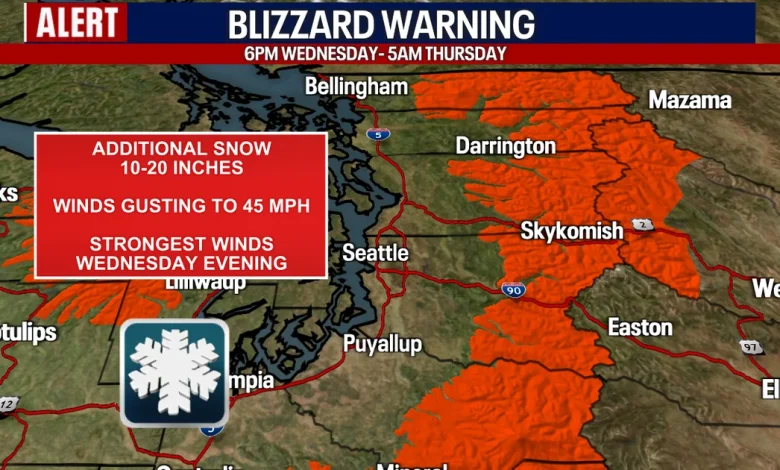
The Blizzard Warning is in effect for the Washington Cascades from 6 p. m. Wednesday through 5 a. m. Thursday ET. Chief Meteorologist Brian MacMillan says the best chance for blizzard-like or whiteout conditions will be after 10 or 11 p. m. Wednesday ET. Forecasts call for higher elevations to likely receive between 10 to 20 inches of new snow with wind gusts up to 45 mph, and those gusty winds are expected to create near whiteout conditions for the mountains Wednesday night.
How avalanche danger and local operations are being framed
Meteorologist Abby Acone emphasizes that avalanche threat is concentrated in the backcountry, while roads and ski areas maintain separate mitigation systems. The Northwest Avalanche Center places areas on the west side of the Washington Cascades at an avalanche risk of four out of five — a designation described as dangerous and potentially life-threatening for anyone in the backcountry — while the eastern slopes of the Cascades sit one level lower at “considerable” avalanche danger.
“Normally, when we’re talking about the avalanche threat, we’re really pinpointing what’s going down in the backcountry, so not necessarily WSDOT roads or the ski resorts — which have their own avalanche mitigation teams — but we are talking about skiers and snowboarders in the backcountry, ” says Meteorologist Abby Acone. She adds, “Really intense mountain snow is expected, especially early Thursday morning through Friday. “
Social and economic dimensions: ski towns, commuters and preparation
The storm carries a split personality for the region: lowland communities will see rain and gusty winds, while mountain towns welcome heavy snow that can both boost recreation and raise hazards. Acone notes that this late-season accumulation comes as mountain snowpack stood in the 30th and 40th percentile of normal, creating urgency to “play catch up. ” She warns that while Saturday and Sunday are expected to be spectacular for skiers and snowboarders, a sudden increase in temperature on Monday and Tuesday could quickly flip precipitation from snow to rain, shortening the window of opportunity for sustained snow benefits.
For travelers, the combination of heavy snow, high winds and avalanche risk changes the calculus for who can safely move through the region. Chief Meteorologist Brian MacMillan highlights the tight timing of the most dangerous conditions, pointing to the late-night hours as the period with the greatest potential for whiteout conditions and rapid change.
What officials and communities are doing
Ski resorts and highway maintenance crews manage avalanche mitigation and road safety independently, and those separate programs remain central during this event. Weather alerts are expected to continue for the mountains through the end of the workweek, and forecasters brief that passes may switch to rain at some point during the day Wednesday before the colder, intense mountain snow settles in.
Public messaging is focused on discouraging backcountry travel while the avalanche risk is high and urging caution for anyone planning to travel over the passes during the late-night window when whiteout conditions are most likely.
The pass road that opened the story now feels charged with a different meaning: what looked like a brief commute could become a test of preparedness when the blizzard warning takes hold. As mountain communities and backcountry users weigh opportunity and danger, the warning stands as a clear prompt to stay informed, limit exposure, and let mitigation teams do their work while the storm moves through.