Wellington flash flooding has turned a severe weather event into an urgent test of the capital’s emergency systems. After torrential rain pushed the region into a state of emergency, officials are now warning that the next 24 hours could be decisive for people in low-lying and flood-prone areas. The picture emerging is not just one of damaged roads and flooded homes, but of a city facing repeated shocks from rain, slips and rapidly rising water. The scale of the disruption has forced authorities to shift from response to prevention.
Emergency Powers, Red Warnings and a Narrow Time Window
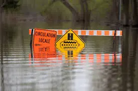
A state of emergency was declared in the Wellington region after heavy rain intensified flood and slip risks across the capital and surrounding areas. Heavy rain warnings for Wellington and Wairarapa were lifted to red until Tuesday night, reflecting the seriousness of the forecast. MetService warned the rain posed a threat to life through dangerous river conditions, significant flooding and slips, while Wellington Civil Defence Emergency Management said the declaration was needed to support ongoing response efforts.
Group controller Carrie McKenzie said the powers would help responders coordinate evacuations, manage infrastructure impacts and keep people safe. Her warning was direct: the priority is life safety. Residents in low-lying and flood-prone areas were told to leave for somewhere else for the next 24 hours rather than wait for conditions to worsen. In practical terms, this means Wellington flash flooding is being treated not as a passing nuisance but as an immediate safety issue.
What the Rain Reveals About Wellington Flash Flooding
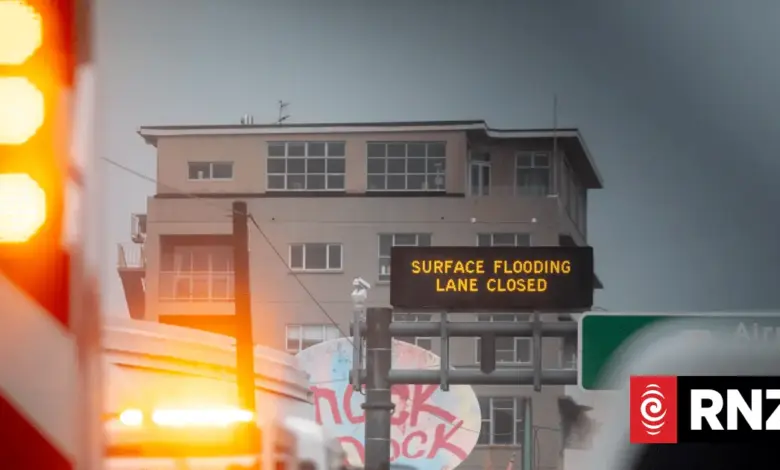
The latest damage sits on top of a wider pattern of severe weather. In one of the most striking figures to emerge, Wellington had 77 millimetres of rain in less than an hour, described as the heaviest rainfall on record. That intensity helps explain why flash flooding spread so quickly through central and southern parts of the city, closing roads, triggering landslides and forcing people from homes during the night.
Fire and Emergency said it responded to 150 calls for assistance overnight, underscoring how quickly demand can outpace normal systems when rainfall concentrates over a short period. The weekend storm also affected multiple parts of the North Island, adding pressure to a region already dealing with fresh damage. A home in Karori was hit by floodwaters and debris, while another report described cars floating in Mount Cook, a vivid sign of how little time residents had to react once water surged through streets.
The deeper issue is that Wellington flash flooding is exposing how vulnerable urban areas can become when rain arrives in bursts rather than gradually. Low-lying streets, steep terrain and already saturated ground create conditions where water can move from inconvenience to emergency in minutes. The risk is not only flooding itself, but the chain reaction that follows: road closures, slip hazards, blocked access routes and the possibility that some residents may be cut off before help arrives.
Evacuations, Rescue Efforts and Community Impact
Authorities urged people in flood-prone spots to move to higher ground for at least the next 24 hours, and an assistance centre was set up for those who need to evacuate. Police said a search was under way for a man living at a flooded property in Karori, while some residents were still dealing with the aftermath of flooded homes and landslides. The emergency response is therefore operating on two fronts: immediate protection and follow-up support for those already affected.
There is also a social dimension to the crisis. When officials tell people not to wait for formal warnings, they are acknowledging that hesitation can be dangerous in a fast-moving event. The repeated flooding referenced by emergency managers suggests many residents are no longer facing a single isolated storm but an accumulating pattern of risk. That is what makes Wellington flash flooding especially significant: it is not only about rainfall totals, but about how frequently communities are being asked to absorb disruption.
Regional Consequences and the Broader Weather Pattern
The Wellington region is not dealing with this in isolation. Severe weather over the past few days has pounded New Zealand, with the North Island hit by flooding over the weekend and earlier severe weather causing damage overnight on Friday. The result is a wider emergency environment in which one region’s rainfall can quickly become another region’s logistical problem, especially when river levels, slips and transport links are all under strain at once.
For Wellington, the broader consequence is clear: each round of intense rain increases pressure on infrastructure, emergency services and public confidence. If heavy rainfall continues, the main question is no longer whether the city will face disruption, but how quickly residents can move before the next wave of flooding arrives. In that sense, Wellington flash flooding has become a measure of both weather severity and urban resilience — and the next 24 hours may show how much of each the capital has left.