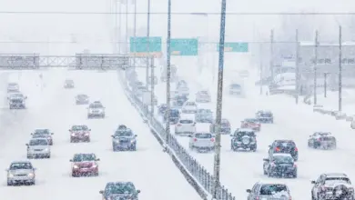
steinternbachonline is tracking a fast-moving Alberta clipper that is pushing heavy snow, mixed precipitation, and thunderstorms across a wide stretch of Canada on Tuesday, April 8, 2026, in Eastern Time. The system is expected to drop 10 to 30 centimetres of snow from northeast B. C. to Ontario, with the Prairies taking the first hard hit.
Snow alerts spread across the Prairies
Environment Canada has placed parts of northeastern B. C. ’s Peace region, a swath of Alberta north of Edmonton, areas around Prince Albert, Sask., and the Winnipeg area under yellow-level snowfall warning alerts. Special weather statements are also in place for Regina, Moose Jaw and Saskatoon as the storm moves through.
The system began in west-central Alberta and is now bringing heavy snow across the Prairies before tapering eastward. A federal weather meteorologist said it will end shy of Thunder Bay, Ont., while northern Alberta is expecting about 15 centimetres, central Saskatchewan and Manitoba up to 20 centimetres, and western Manitoba’s Parklands region 15 to 30 centimetres.
What forecasters are watching now
Danielle Desjardins, a warning preparedness meteorologist with Environment and Climate Change Canada, said the storm is already changing what snow-free areas look like. “Any of the snow-free areas will be covered tonight, ” Desjardins said.
She added that the timing matters because April conditions can make the same system behave in very different ways across short distances. “It’s going to look much more wintery than we would expect – given that it’s already April, ” Desjardins said.
As the Alberta clipper tracks east, colder air is expected to move in behind it. Desjardins said temperatures will fall below zero, and rain in some places will switch to snow tonight.
Why this system is producing such a wide impact
Alberta clippers are fast-moving, low-pressure systems that originate in Alberta, just east of the Rocky Mountains, and track east to southeast across southern Canada and the northern United States. This one is taking advantage of warm air to the south and arctic air still lingering to the north, which helps explain why it can produce such a broad mix of snow and precipitation.
Desjardins said that setup is not unusual for this time of year. “This time of year, we do tend to see these types of systems track through because they can tap into a lot more energy and moisture with the warm temperatures to the south and the arctic air still remaining to the north, ” she said.
What comes next for Steinbachonline readers
For now, the key concern is how quickly conditions will change as the storm slides east and pulls in colder air. The Prairies are expected to see more wintery weather follow, and Desjardins said the pattern is likely to stay unsettled for the next week or so, with temperatures and precipitation type shifting from one area to the next. For Steinbachonline readers watching the storm’s path, the main takeaway is that the Alberta clipper is not done yet, and the next round of changes may arrive quickly.