Emergency crews and meteorologists are warning of a late-season tempête hivernale moving through Quebec, driven by a string of fast-moving clippers and a stronger system due later in the week. Environment Canada meteorologist Kathleen Maynard said scattered accumulations already fell this weekend across the Greater Montreal area and the regions to the east and south, and a more robust system could bring snow, freezing rain or rain starting Thursday. Updated 16: 50 ET.
Tempête Hivernale: Expanding details and the immediate picture
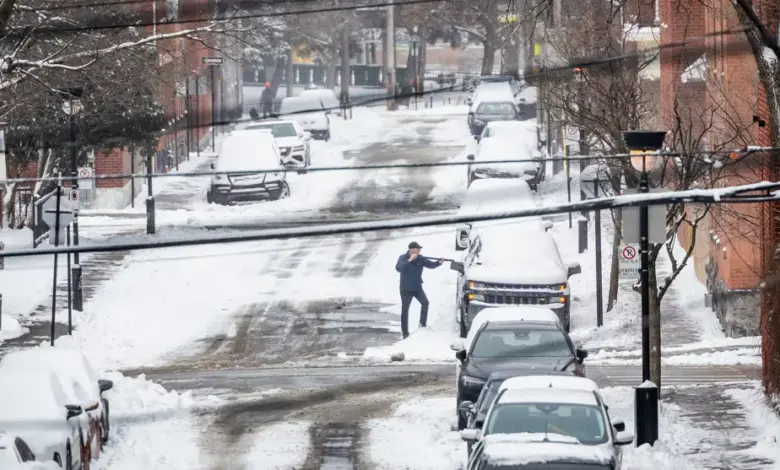
The weekend delivered measurable snow: about 10 to 15 cm in Greater Montreal, Montérégie, Drummondville and Estrie; specific totals included roughly 9 cm in Montreal, 12 cm in Trois-Rivières, about 15 cm in Joliette and 16 cm in Drummondville, figures cited by Kathleen Maynard, meteorologist, Environment Canada. Earlier forecasts from Environment Canada had suggested about 5 to 10 cm for parts of the region, with localized precipitation rates reaching 2 cm per hour and reduced visibility at times.
Wind played a role in the travel impact: gusts of 30 to 50 km/h produced wind chill near -8 in Montreal during the afternoon and may have caused blowing snow in exposed areas, said Maynard. Quebec’s road-monitoring service Québec 511 logged a single-vehicle run-off on Autoroute 20 at kilometer 130 westbound near Saint-Hyacinthe, which led to the closure of one lane, and a separate accident closed Autoroute 40 eastbound at exit 77 (Lacordaire Boulevard) in Montreal.
Tempête Hivernale: Immediate reactions from experts and affected parties
Kathleen Maynard, meteorologist, Environment Canada, warned: “This is not really spring weather, ” and stressed uncertainty about precipitation type in the Montreal region as the system evolves. Maynard added: “It will start as snow in the Montreal region and sweep as far as Quebec City, Saguenay, Bas-Saint-Laurent and Gaspésie, and it will sweep a large portion of the province. “
Alexandra Giroux, meteorologist, summarized the clipper pattern: “With this small succession of systems, we do not necessarily expect large amounts of precipitation, but it will definitely be gray over the next days. “
Josée Cusson, communications director, Association of Ski Resorts of Quebec, noted the silver lining for winter recreation: “With what fell over the weekend, we received 25 centimeters in Estrie! The scenery has completely changed: we could see grass, and now it’s winter again. “
What’s next: outlook and travel advice
Forecasters say the sequence of clippers will begin Thursday and continue into the weekend with generally modest totals from each quick-moving system, though a stronger system on Thursday could produce a mix of snow, freezing rain or rain in some sectors, Environment Canada warned. Additional light flurries are expected Monday and overnight Tuesday to Wednesday, with a chance of a few centimeters again midweek, Maynard added.
Authorities and transportation services are preparing for continued caution on roads and potential lane closures; municipalities have already mobilized snow-clearing crews in urban areas. Motorists are urged to expect reduced visibility and winter driving conditions where accumulations persist, and to consult local travel advisories before setting out.
As the province watches the evolving tempête hivernale pattern, forecasters will refine the track and precipitation-type forecasts over the next 48 hours, with updated advisories to follow if the system intensifies or shifts. Updated conditions and guidance are expected through the coming weekend; the situation will be monitored closely by Environment Canada and regional authorities into the next week.