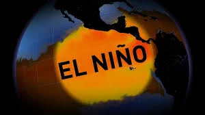
Monitors in a forecasting room glow with maps of the tropical Pacific as scientists track a shift that could become super el nino 2026 — a change that forecasters say may be most visible in weather patterns this winter.
Could Super El Nino 2026 form this year?
The U. S. Climate Prediction Center (CPC) projects a high likelihood that El Niño conditions will develop this summer, with one forecast placing the chance above 80 percent by the latter half of the season. Another CPC posting raised the possibility of El Niño forming by fall to 62 percent. Forecasters working with current observations and computer model guidance see many indications that a strong event could emerge later this year, but they emphasize uncertainty.
How strong might a super el nino 2026 become, and what does “super” mean?
In meteorological conversation, the label “super” is used informally for very strong events when eastern Pacific water temperatures run substantially warmer than normal. Historical comparisons point to past events where ocean surface anomalies exceeded about two degrees Celsius. Model guidance suggests a strong — and possibly very strong — El Niño could develop, and the CPC places roughly a one-in-three chance that such an event would qualify as strong by autumn. Dr. Doug Gillham, a senior meteorologist, cautions that “El Niño and La Niña have a long history of defying expectations during spring, more so than any other season, ” and he adds that “it is premature to have confidence in the eventual strength. ” That combination of model momentum and seasonal unpredictability is central to how forecasters frame the coming months.
What might this mean for the Pacific Northwest, and what are officials doing?
Deputy state climatologist Karin Bumbaco describes the typical imprint of El Niño on the Pacific Northwest: warmer-than-average temperatures and below-normal precipitation in fall and winter, which can lead to a smaller snowpack, lower spring runoff and a greater chance of drought and wildfires in Idaho, Oregon and Washington. She notes that El Niño often redirects storms toward California, producing relatively less rain and snow for Western Washington over a season. With parts of the region already experiencing drought conditions and low snowpack, those signals heighten concerns about water supply and wildfire risk.
In response, meteorologists have issued an El Niño watch and model teams continue to refine projections. Forecasters say they will firm up seasonal outlooks as spring progresses; Bumbaco observes, “We’re talking about the season as a whole. We are farther out in the forecast, and we’ll firm out later in the spring. ” The CPC and operational centers are using ongoing ocean observations and model runs to update probabilities and guidance for resource managers, water planners and emergency officials.
What are the human and economic stakes, and how do experts frame uncertainty?
Even a couple degrees of ocean warming can cascade into atmospheric changes with real consequences for communities, infrastructure and industries that depend on predictable seasonal water and storm patterns. Broadly, El Niño’s most pronounced effects occur in winter when the jet stream is strongest, but summers that transition toward a strong El Niño can influence seasonal rainfall patterns and wildfire risk. Experts emphasize that while computer models now point toward a likely El Niño, the spring predictability barrier — the tendency for forecasts made in spring to change — means communities and planners must prepare for multiple scenarios.
Back in the forecasting room, the glow of ocean-anomaly maps is no longer abstract: the CPC’s probability updates and model ensembles drive conversations with state climatologists and emergency managers. Whether this develops into the event some call “super” remains uncertain; forecasters will watch ocean temperatures and atmospheric responses closely through the spring and summer.
The coming months will test the balance between model guidance and seasonal unpredictability. For now, monitors keep tracking the tropical Pacific, officials refine contingency plans, and communities brace for the range of outcomes that a strong El Niño could bring.