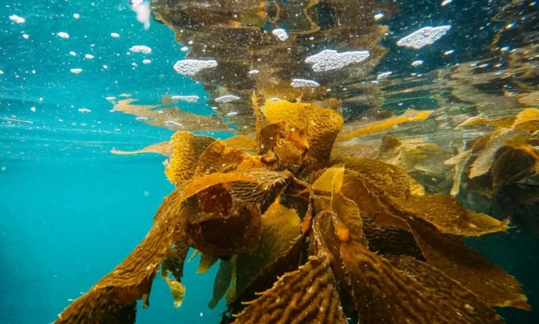
Introduction: In a striking application of deep learning, researchers at UCLA’s Institute of the Environment and Sustainability produced the most detailed statewide maps of California’s kelp forests to date, using Planet’s Dove satellite imagery. Funded by the California Ocean Protection Council and The Nature Conservancy, the project yields maps 10 times more detailed than previous 30-meter records and gives conservation managers new, local-scale visibility into kelp condition and restoration outcomes.
Background & context
California’s kelp forests underpin fisheries, biodiversity and coastal recreation, and they contribute to nutrient cycling and carbon sequestration. Recent declines in kelp abundance have threatened these ecological and economic functions. The UCLA team, supported by the California Ocean Protection Council and The Nature Conservancy, applied AI-driven methods to Planet’s Dove satellite constellation to overcome the coarse spatial limits of legacy 30-meter satellite records.
Deep Learning and High-Resolution Kelp Mapping
The technical advance hinges on applying AI deep learning to 3-meter Planet Dove pixels, producing kelp-canopy maps an order of magnitude finer than standard datasets. The study defined average kelp canopy persistence as the number of years kelp was present in each 3 m pixel across the 2017–2024 period and summarized persistence in 10 km × 10 km grids along the coast where kelp occurred at least once during that span.
These higher-resolution observations exposed sharp regional differences in recovery after the 2014–2016 marine heatwave. In Sonoma and Mendocino counties, kelp losses exceeded 90% and remain historically low. By contrast, parts of central and southern California displayed greater resilience. Persistence after the heatwave correlated with prior stability and with local factors such as ocean temperature, depth and habitat fragmentation—insights that coarser products can miss.
The new maps also enable detection of fine-scale patterns relevant to experimental restoration and kelp harvest management. Where kelp persistence is sparse, refined spatial resolution permits assessment of small restoration plots and localized responses to interventions, expanding the practical toolkit available under the state’s Kelp Restoration and Management Plan. The findings are presented in a recent paper published in Nature Communications Earth and Environment.
Expert perspectives and outlook
“Refined spatial resolution of kelp canopy monitoring has become increasingly important for assessing the efficacy of experimental restoration techniques and managing kelp harvest, particularly in areas where persisting kelp is sparse, ” said Dr. Kristen Elsmore, senior scientist, California Department of Fish and Wildlife.
Lead author Kate Cavanaugh emphasized that the high-resolution data can be used to track small-scale restoration efforts and guide management toward greater kelp forest resilience. The project’s maps and derived persistence products are made available through an open-access, interactive platform developed in collaboration with The Nature Conservancy, UCLA, NASA, Woods Hole Oceanographic Institution and UC Santa Barbara, giving scientists, conservationists and community stakeholders direct access to the new datasets.
Operationally, managers now have the ability to locate where kelp is struggling or thriving at scales relevant to on-the-ground interventions. The mapping also creates opportunities to evaluate how local ocean temperatures, depth gradients and habitat fragmentation interact with historical stability to shape recovery trajectories. Those relationships will inform where restoration investments are likely to yield the greatest ecological return.
While legacy 30-meter records remain valuable for long-term trends, the finer-grained view from AI-enhanced satellite data reframes monitoring and adaptive management for California’s kelp ecosystems. As restoration experiments scale up, this mapping approach provides a more precise baseline for measuring success and refining techniques.
Looking ahead: How will managers and restoration practitioners integrate these detailed persistence maps into prioritization, permitting and harvest rules to bolster kelp recovery in the regions that remain most depleted by past warming events—and how will continued use of deep learning reshape coastal ecosystem monitoring more broadly?