The Centro Nacional de Información Geográfica has inaugurated a new Casa del Mapa in palencia, a public space that brings official cartography, specialist publications and technical assistance under one roof. Located in the Edificio de Usos Múltiples of the national Administration, the facility is presented as both a service point for citizens and a practical tool for emergency responders, while also expanding retail and outreach products for hikers and astronomy enthusiasts.
Background: Why Palencia’s Casa del Mapa matters
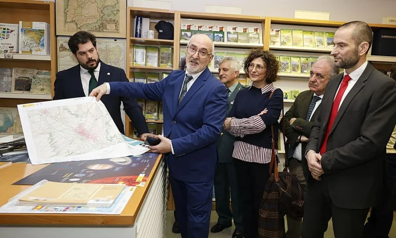
The new Casa del Mapa occupies a visible spot in the Edificio de Usos Múltiples (Avda. Simón Nieto, 10) and replaces the previous office with improved accessibility and space for a shop, storage and technical attention. Officials present at the opening emphasized that the site allows any citizen to consult, acquire or receive advice on maps, plans and specialised publications. The Centro Nacional de Información Geográfica and the Instituto Geográfico Nacional provide the cartographic material, and the Palencia office is noted among the highest-volume branches nationwide, ranking second or third within the treintena of comparable units around the country.
Deep analysis: operational roles, public demand and product reach
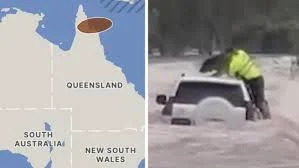
The Casa del Mapa in palencia serves several distinct functions that intersect public service and consumer demand. Operationally, IGN-produced cartography is a working tool for Fuerzas y Cuerpos de Seguridad del Estado, emergency services, firefighters and Protección Civil; precise, up-to-date territorial information is routinely used in decisions for floods, fires and search operations. The Palencia office consolidates these resources locally while offering citizens curated topographic maps, historical plans and bespoke prints of any Spanish territory. On the consumer side, the post-pandemic rise in outdoor activities has driven demand for topographic materials from hikers and cyclists, prompting the office to expand retail offerings — from municipal maps and historical city plans to puzzles, posters and themed promotional items tied to natural parks and the night sky.
Expert perspectives and wider impact
Emilio López Romero, director of the Centro Nacional de Información Geográfica (CNIG), said, “The Casa del Mapa brings geographic information closer to citizens and gathers their demands, ” underlining the role of IGN technicians who keep Spain’s cartography current and reinforce territorial information. Eduardo Santiago Calleja, subdelegate of the Government in Palencia, described the space as “not just a point of dissemination, but a link between scientific knowledge, technology and public service, ” stressing that closer cooperation between administrations improves public services’ response capacity. Jesús Sáez, responsible for the CNIG store in Palencia, explained the customer profile: “We provide a complete assistance and sales service for cartographic products. Right now one of our main clients is the outdoor routes enthusiast, ” and he noted that users often request municipal maps and topographic guides.
Those expert observations frame two clear impacts. First, the Casa del Mapa is an operational multiplier for emergency planning and execution: up-to-date topography supports faster, safer decision-making in extreme weather and critical incidents. Second, the retail and outreach expansions make official cartography a cultural and recreational resource — historical city plans, puzzles and astronomy materials broaden public engagement with territory and science.
Regional consequences and a forward look
The Palencia office’s prominence among the network of Casas del Mapa signals a regional concentration of demand for authoritative cartographic products. Local administrations, security bodies and citizens gain a walk-in point for expert guidance and purchases, reducing frictions between national geospatial producers and end users. The Casa del Mapa is also preparing materials tied to an upcoming astronomical event: the IGN has developed digital viewers, specific publications and protective eyewear that will be available in the space, aligning geographic outreach with science communication efforts.
By embedding a multifunctional cartographic hub in the heart of the administrative building, the CNIG aims to sustain both operational readiness for emergencies and everyday access for hikers, historians and curious citizens. Will the model demonstrated in palencia be scaled to keep pace with rising public interest in outdoor recreation and the steady technical demands of emergency services?