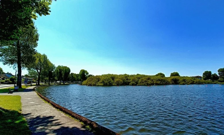
On the Lough in Cork City the water lies low and grey under a mild, overcast sky — a small, lived-in scene that captures the island’s shifting moods. The ireland weather here is soft enough for coats to feel optional, with temperatures hovering near 10ºC and an afternoon peak close to 11ºC, but forecasts warn that the calm will not hold for long.
What is the Ireland Weather forecast for the coming days?
Met Éireann has set out a pattern that begins with another dry day for many before conditions turn “wet and breezy” in the early part of the week. The east and midlands can expect some sunny spells while the west will be cloudier, with rain along the west coast and a possibility of spot flooding. Highest daytime temperatures are expected to be broadly in the 8 to 12C band, with overnight lows of 2 to 7C and milder readings where cloud cover persists in the west.
Monday looks to bring a mix of cloud, sunny spells and patches of rain or drizzle, with highs around 7 to 12C. Tuesday will offer only limited bright spells as conditions turn cloudier, with more persistent rain developing in the west and southwest and daytime highs around 10 to 13C. Midweek will grow windier: Wednesday should start mostly dry with spells of sunshine before showers arrive, with highs of 9 to 11C, while Thursday shows signs of being another windy day with widespread showers or persistent rain. Showers and rain may be heavy at times, with a chance of hail and thunder and highs closer to 7 to 10C.
“After the recent spell of dry and bright weather, our weather is going to turn more unsettled again this week, with some spells of wet and breey weather on the way, ” said Donal Egan, meteorologist at Met Éireann.
How will these conditions play out from Cork to the west?
In Cork the week has begun mild and cloudy. For many in the city it’s a dry day with the odd isolated shower possible, and a peak near 11ºC before temperatures slip back overnight. Met Éireann highlights the risk of downpours for Leeside later in the evening that may continue into the early hours. Further west, persistent rain and cloudier conditions mean a greater exposure to heavier downpours and the localised risk of spot flooding.
The regional forecast for Munster mirrors the national picture: a largely dry start across much of the province with brighter spells in some eastern areas, cloudier conditions and persistent rain developing in the west and southwest, and highest temperatures generally between 8 and 12 degrees. Looking later in the week, there is a signal of a major shift on Thursday with heavier downpours and a notable drop in temperatures, followed by an improvement that should bring a mix of cloudy spells and sunshine and, by Saturday, a return of long stretches of spring sunshine — though forecasters note that longer-range details could change as models are refined.
How are forecasters framing uncertainty and what are they advising people to watch?
Forecasters are clear that uncertainty grows beyond midweek. Met Éireann’s outlook for the rest of the coming week describes conditions as “continuing unsettled. ” That uncertainty centres on timing and intensity: showers and rain may be heavy at times, and there is a stated chance of hail and thunder in some spells. The practical watchpoints are therefore the west coast and low-lying areas where spot flooding has been flagged, and the timing of the windier interludes mid- and late-week.
Met Éireann is maintaining the public forecast and daily updates as the situation evolves; the agency’s statements and outlooks are the primary source for changes in timing and severity.
Back on the Lough, the clouds that have settled over the water carry a clearer message now: a mild, quiet moment that may be followed by a week of wet, windy returns and then — possibly — the return of spring sunshine. Residents watching the ireland weather will be waiting to see whether that hope materialises or another shift arrives instead.