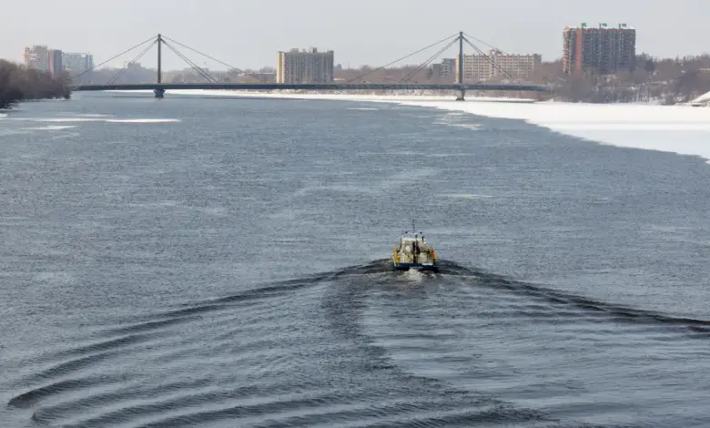
Montréal’s warning is clear: inondations may not be visible yet, but the city is acting as if they could arrive quickly. The agglomeration has activated its Plan particulier d’intervention, while officials say up to 25 millimeters of rain could fall in Montreal through Thursday, with totals possibly rising later in the week. The highest risk remains along the Rivière des Prairies, where several neighborhoods are being watched closely.
What is Montréal not saying outright about the risk?
The city is not declaring an emergency, but it is behaving as if one may be close. That distinction matters. The Plan particulier d’intervention is currently at level 2, which means emergency measures are not yet in effect, but can be deployed if conditions worsen. In practical terms, that opens the door to large-scale sandbag distribution, emergency pumping, and specialized resources if needed.
Mayor Soraya Martinez Ferrada, Mayor of Montréal, said the city’s “priority” is the safety of residents and that water levels are being monitored continuously. Her office added that forecasts point to a rise in water levels, requiring stronger preparation. The message is cautious, but the operational response is already underway.
The neighborhoods identified as most exposed include Pierrefonds-Roxboro, L’Île-Bizard–Sainte-Geneviève, and Ahuntsic-Cartierville. More broadly, all areas bordering the Rivière des Prairies are being told to prepare for spring freshets, with tighter surveillance in the west of the island. That focus suggests the risk is not evenly distributed across the city; it is concentrated where geography has long made runoff and rising water harder to manage.
Why are officials watching the weather so closely now?
Environment Canada says several waterways in Québec are under observation because of a succession of weather phenomena. Julien Pellerin, meteorologist at Environment Canada, explained that there is still a good snow cover north of the St. Lawrence Valley, and that this snow is mature enough to absorb little water. When warmth arrives, water runs off quickly and snow melts faster. That combination increases pressure on rivers and smaller tributaries.
Across Québec, 40 to 70 millimeters of precipitation are expected in the coming days. In Outaouais, the Laurentians, and Lanaudière, minor or even moderate flooding could occur. Pellerin stressed that the major rivers, such as the St. Lawrence and the Ottawa River, already have high flows, but the sharper danger lies in affluents and smaller rivers. That detail is central: the threat is not only from large, headline-grabbing waterways, but from the less visible channels where water can rise quickly.
Maude-Émilie Lapointe, spokesperson for the Ministère de la Sécurité publique, said five monitored waterways were already classified as minor flooding, while 17 others were under surveillance. She also identified the regions most likely to see the largest rises in river levels: Outaouais, the Laurentians, Lanaudière, and the Capitale-Nationale, with Bas-Saint-Laurent, Gaspésie, and Nord-du-Québec also on watch.
Who is most exposed if the water rises?
In Montréal, the answer is clear: residents near the Rivière des Prairies and households in low-lying sectors face the earliest pressure. The city says some preventive protections have already been installed in vulnerable areas, and more could follow depending on how the water evolves. That means the response is staged, not final. The next few days will determine whether the city remains in preparedness mode or moves into full intervention.
The wider pattern is just as important. Philippe Gachon, a hydrometeorology risk specialist at Université du Québec à Montréal and general director of the Réseau Inondations InterSectoriel du Québec, said the coming weeks are crucial because rapid snowmelt, sustained positive temperatures, and intense precipitation can combine to make rivers overflow in some sectors. He added that the risk is elevated this year for certain areas because the snowpack remains significant in places.
Gachon said the Ottawa River will be “particularly under surveillance, ” with water inputs that could be extremely important. Lapointe noted that retention structures and dams can influence water levels and that maneuvers are possible. That means the coming response will depend not only on weather, but also on how effectively hydraulic systems can absorb the shock.
What does this say about the larger flood picture in Québec?
Verified fact: this is not being framed as a repeat of the major floods of 2017 and 2019. Lapointe said the current conditions are not aligned for major flooding on that scale. But the comparison still matters because it sets the boundary between caution and panic. The risk today is smaller in absolute terms, but broader in geographic spread and more immediate in local impact.
Analysis: the pattern emerging from the city’s warning, the provincial surveillance list, and the federal weather assessment is one of layered vulnerability. Montréal is preparing for inondations while provincial officials are tracking multiple basins, and federal meteorology points to snowmelt and rain acting together. The hidden truth is not that a catastrophe is certain. It is that the system is already being tested by a familiar spring combination that can produce isolated but disruptive flooding before the public fully registers the threat.
The next step is transparency. Residents in the highest-risk neighborhoods need clear, timely updates on water levels, protective measures, and the conditions that would trigger escalation from level 2 to active emergency operations. With inondations once again shaping municipal planning, the public should see not only the warning, but the logic behind it.