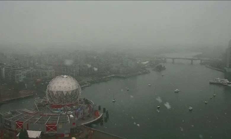
Vancouver Weather Forecast: Environment Canada has expanded a special weather statement for low-elevation snowfall from Metro Vancouver into other parts of southwestern British Columbia, including Vancouver Island, setting out a patchwork of accumulation expectations that complicate travel planning.
What do the official statements show?
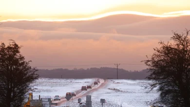
Environment Canada expanded a special weather statement that covers low-elevation snowfall across multiple coastal and inland zones. The advisory places Greater Vancouver, the Sunshine Coast, Howe Sound and the Fraser Valley in a zone where up to four centimetres is possible near sea level. Inland areas of North Vancouver Island are cited for higher totals, with expectations of upwards of 10 centimetres. Higher elevations are expected to see still larger accumulations: the Sea to Sky Highway corridor from Squamish to Whistler could receive as much as 15 centimetres by the end of Tuesday. Separately, the Coquihalla Highway remains under a snowfall warning with forecasts of up to 30 centimetres.
How does the Vancouver Weather Forecast change driving risk?
The weather office links the event to a cold, unstable air mass and highlights that drivers should prepare for challenging driving conditions. The contrast in forecasted totals—small amounts at sea level in some coastal areas and substantially larger amounts on specified inland and high-elevation corridors—creates a scenario where route choice and elevation will materially affect travel safety. The Coquihalla Highway’s active snowfall warning and the Sea to Sky Highway’s higher-elevation accumulation estimate are notable because the Coquihalla was cited as having been backed up over the weekend due to weather-related crashes, and the new warning reinforces that risk in that corridor.
Which areas face the greatest operational impact and what remains unspecified?
The expanded statement identifies specific regions and amounts but leaves operational details such as staged road restrictions, exact timing of peak snowfall across each corridor, and the duration of travel impacts unspecified in the available statement. Known focal points of impact are the Coquihalla Highway (up to 30 centimetres), the Sea to Sky Highway between Squamish and Whistler (as much as 15 centimetres), inland North Vancouver Island (upwards of 10 centimetres) and low-elevation coastal zones including Greater Vancouver and adjacent coastal communities (up to four centimetres). Environment Canada attributes the conditions to a cold, unstable air mass and communicates that drivers should prepare for challenging driving conditions.
Verified facts are: Environment Canada expanded a special weather statement; specified accumulation ranges for the named regions; the Coquihalla Highway is under a snowfall warning for up to 30 centimetres; the Sea to Sky Highway could see as much as 15 centimetres by the end of Tuesday; inland North Vancouver Island could expect upwards of 10 centimetres; low-elevation coastal areas including Greater Vancouver, the Sunshine Coast, Howe Sound and the Fraser Valley could see up to four centimetres; and the event is attributed to a cold, unstable air mass with a direct advisory that drivers should prepare for challenging driving conditions. The public-facing information does not include additional operational measures or localized timing beyond the amounts and warnings provided.
For communities and travelers tracking this developing situation, the Vancouver Weather Forecast underscores a geographically uneven event with clear risks on higher-elevation corridors and an explicit warning for drivers to prepare for difficult conditions.