Weather alert: Significant rainfall, snow and flood risks threaten southern Ontario — 5 key impacts

A special weather statement is in effect as Environment Canada warns of significant rainfall in the region: Toronto could receive 20 to 40 millimetres of rain through Wednesday, and broader southern Ontario faces mixed precipitation and flood risk. The unfolding weather setup — a series of low-pressure systems stretching from Windsor to Cornwall — raises the prospect of rapid runoff, localized flooding and transitions to snow and ice later in the week.
Background & context: who is in the path
Environment Canada has issued advisories across southern Ontario, noting that the 20–40 mm rainfall forecast for Toronto may be exceeded in thunderstorm-prone areas. The agency warns, “A series of low-pressure systems will lead to significant rainfall across parts of southern Ontario. Heavy downpours may cause flash floods and water pooling on roads, ” and indicated that statements may be upgraded to formal warnings.
Advisories extend from Windsor in the west to Cornwall in the east. Central Ontario and the Bruce Peninsula are also flagged for a prolonged period of freezing rain, while an advisory for Petawawa notes up to 10 millimetres of rainfall. Forecast rainfall and freezing-rain totals elsewhere include southern Ontario totals in the 20–40+ mm range and freezing-rain accumulations of 5–20+ mm, especially through eastern Ontario.
Weather drivers and deep analysis
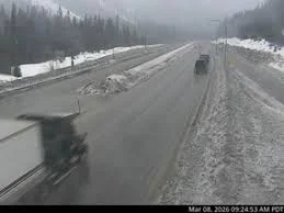
The event is being driven by a complex storm system that will carry multiple precipitation types across the province from Tuesday into Wednesday. The system’s moisture and dynamics explain why southern Ontario will see heavy rain and thunderstorms in the morning, with rain, freezing rain and snow spreading into central and southern zones by evening. In the southwest, overnight thunderstorms are a distinct possibility.
Impacts stem from three interacting drivers: precipitation intensity, temperature gradients and the storm track. Intense short-duration downpours in urban centres increase the risk of flash flooding and road pooling, while the arrival of colder air later in the event can flip rain to a wintry mix or snow, complicating response and travel timing. The forecasted temperature swing for Toronto illustrates the transitionary nature of the event: highs near 13 C on Tuesday fall to 5 C by evening, then to 11 C on Wednesday daytime before dropping to -3 C by Wednesday evening; late-week readings are expected to hover near 1 C on Thursday and Friday, with flurries possible.
Prolonged freezing rain east of Georgian Bay and toward the Ottawa Valley raises separate concerns: ice pellets and accretion can lead to slick untreated surfaces, fallen tree branches and potential multi-day power outages where significant ice accretes. Heavy snow is also anticipated east of Lake Superior, where 5–15+ cm accumulations are expected between that area and North Bay, amplifying travel and infrastructure strain in those corridors.
Regional impacts and expert perspectives
Flood watches are already in effect for parts of southern Ontario, with flood warnings issued for communities along the Grand River, including Brantford, New Hamburg and Haldimand County. Environment Canada lists potential impacts through the week: power outages, slick road conditions, flooding, ice jams and fallen tree branches.
“March can be a moody month. Sometimes it offers a taste of the warmer weather ahead. Often it presents that tease before a return to winter’s wrath. Such will be the case for this week’s forecast, ” said Bill Coulter, Meteorologist.
Local municipalities and emergency planners will be watching the storm track closely, as modest shifts can move the axis of heavier rain and freezing precipitation. The combination of urban drainage limits, saturated or frozen ground in some areas, and higher river flows elevates the risk of both localized and riverine flooding where rainfall totals approach or exceed forecast amounts.
Residents are advised to monitor official alerts from Environment Canada and municipal emergency communications and to prepare for rapid changes in conditions, including the potential for sudden flooding and transitions to ice or snow.
As this system unfolds, will preparedness and local response keep pace with an event that can switch from heavy rain to freezing rain and snow in a matter of hours?