Met Éireann weather warnings are drawing attention tonight because the risk is not confined to one part of the country: six counties are now facing separate yellow alerts that begin at different times and carry different impacts. The timing matters. One warning starts at midnight, another from midday tomorrow, and all are set against a backdrop of difficult travelling conditions, fallen trees and loose debris. For people planning journeys or working outdoors, the practical question is no longer whether conditions will change, but how quickly and where.
Why the Met Éireann Weather Warnings matter now
The latest warnings cover Donegal, Galway, Mayo and Sligo for wind, while Cork and Kerry are covered by a combined wind and rain alert. The warning for Donegal, Galway, Mayo and Sligo begins at midnight tonight and is due to expire at 2pm on Saturday. The Cork and Kerry warning comes into effect from midday tomorrow and is set to end at 8pm on Saturday. The split timing is important because it suggests a prolonged period of unsettled conditions rather than a single short-lived spell.
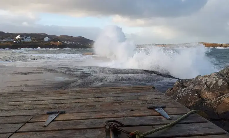
Met Éireann has identified the main potential impacts as difficult travelling conditions, fallen trees and loose debris in the west and north west. In Cork and Kerry, spot flooding is also listed among the concerns. That means the warnings are not only about wind strength; they also point to hazards that can affect roads, local infrastructure and day-to-day movement. In practical terms, the alerts raise the possibility of disruption across a broad stretch of the country at different points over the next day and a half.
What the county breakdown says about the risk
The county-by-county pattern gives a clearer sense of the threat. Donegal is highlighted twice in the wider alert picture, with a second wind warning issued for the county tonight and tomorrow. That second alert begins at midnight tonight and remains in place until 2pm. The forecast for that period includes very strong and gusty south to southwest winds, along with difficult travelling conditions, fallen trees and branches, and debris and loose objects being displaced. A wind warning already in effect for Donegal remains active until 9pm tonight, which means residents there are facing a longer stretch of unsettled weather than in the other counties named.
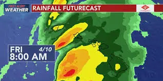
For Galway, Mayo and Sligo, the warning is focused on wind and the associated hazards that typically follow when gusts strengthen across exposed areas. In Cork and Kerry, the added rain element changes the picture slightly, because spot flooding can turn isolated heavy bursts into a separate transport and safety issue. Taken together, the warnings suggest that the immediate concern is not just damage from wind, but the combined effect of wind, wet surfaces and debris on roads and public spaces.
Met Éireann Weather Warnings and the wider disruption risk
Analysis of the alerts points to a familiar but significant pattern: yellow warnings often sit at the threshold where conditions are not extreme everywhere, but enough of a risk exists to justify caution. In this case, the overlap between wind, rain and extended timings increases the chance of local disruption. Fallen trees and loose debris can create sudden blockages, while spot flooding can slow traffic even where road surfaces remain intact. The fact that the warnings are spread across both western and north western counties also suggests that the impacts may be uneven, with exposed routes and higher ground likely to feel the pressure first.
The broader significance lies in the timing. Because one alert starts at midnight and another at midday tomorrow, the weather threat is not concentrated into a single window. That creates a longer period during which travel plans, outdoor work and local services may need to adapt. The warnings themselves do not confirm damage; they identify risk. But that distinction is exactly why they matter: they are a signal to prepare before conditions worsen, not after disruption has already taken hold.
What officials have flagged for people in affected areas
Met Éireann has specifically pointed to difficult travelling conditions, fallen trees and loose debris in the west and north west, with spot flooding added for Cork and Kerry. Those are concrete, practical hazards rather than abstract forecasts. A gusty wind warning can affect drivers on open roads, cyclists, pedestrians and anyone moving near trees or temporary objects that can be lifted or displaced. Where rain is added to the forecast, standing water and reduced visibility can intensify delays and risk.
The warning windows also matter for planning. Donegal, Galway, Mayo and Sligo are under alert from midnight tonight until 2pm on Saturday, while Cork and Kerry face their own warning from midday tomorrow until 8pm Saturday. For anyone in those counties, the safest reading of the situation is that conditions may worsen before they improve. Met Éireann weather warnings now define the immediate outlook, and the key question is how much local disruption the next 24 hours will bring before the alerts expire.